Imagine a scenario where the crowded highways of low Earth orbit (LEO) become a chaotic tangle of satellites and debris, with the risk of catastrophic collisions looming ever larger as commercial space ventures expand at an unprecedented pace, highlighting the urgent need for advanced monitoring systems. This growing congestion, fueled by ambitious projects from global players, underscores a critical demand for innovative management solutions to ensure safety in space. A Chinese aerospace company, Geovis Insighter Technology Co. Ltd., is stepping into this vital arena with a groundbreaking initiative to deploy a constellation of 144 satellites dedicated to space situational awareness (SSA). This ambitious network aims to track orbital traffic and debris with unparalleled precision, offering a potential game-changer for mitigating collision risks. As space becomes an increasingly vital domain for communication, navigation, and scientific exploration, such innovations are essential to safeguarding this shared environment for future generations.
Addressing Orbital Congestion with Advanced Monitoring
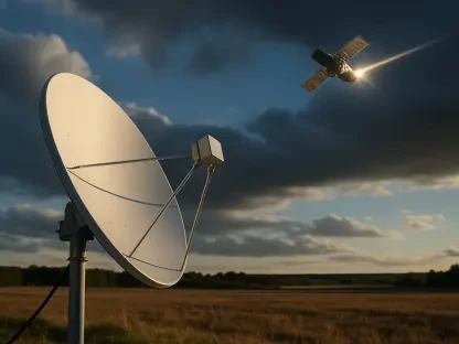
The escalating number of satellites in LEO, driven by large-scale constellations like those for global internet coverage, has turned near-Earth space into a bustling and often hazardous zone. Geovis Insighter’s plan to launch a 144-satellite network specifically for monitoring objects in this region marks a significant step toward addressing these challenges. The project begins with two experimental satellites already in orbit, followed by an additional 12 by the end of 2026, operating initially at an altitude of around 500 kilometers. These satellites will focus on tracking objects between 300 and 2,000 kilometers above Earth, providing detailed data to enhance orbit prediction models. By offering real-time insights into the positions and trajectories of both active satellites and debris, this system promises to reduce the likelihood of collisions that could generate even more hazardous fragments, thereby protecting critical space infrastructure.
Beyond the initial phase, the network’s future expansion into very low Earth orbit (VLEO) demonstrates a commitment to achieving even greater accuracy in monitoring. While maintaining satellites at these lower altitudes requires more fuel due to increased atmospheric drag, the improved precision in tracking smaller debris and satellites is deemed worth the investment. This strategic focus on VLEO reflects an understanding of the nuanced challenges in different orbital zones and aims to provide comprehensive coverage where risks are most acute. The data generated will be crucial for space operators worldwide, enabling more informed decision-making to avoid potential disasters. As orbital congestion continues to grow, such detailed situational awareness becomes not just beneficial but necessary for maintaining the long-term usability of space.
Evolving Role of Chinese Aerospace in Global Space Safety
Geovis Insighter Technology’s transition from a software developer for government projects to a key player in the commercial space sector highlights a broader shift within China’s aerospace industry. Originally focused on SSA software solutions, the company has now pivoted to hardware deployment with this satellite network, targeting a wider audience of private space operators navigating increasingly crowded orbital paths. Listed on the Beijing Stock Exchange earlier this year, the firm’s move into providing actionable space awareness data reflects a trend of growing collaboration between state-backed and commercial entities in China. This evolution positions the country as a significant contributor to global efforts for sustainable space operations, aligning with international priorities to manage the risks associated with satellite proliferation.
Moreover, China’s commitment to space safety extends beyond individual projects to national initiatives aimed at integrating with global frameworks. Efforts to establish a robust space traffic management system demonstrate a proactive stance in tackling orbital challenges. A notable example of innovation in debris mitigation is the Shijian-21 satellite, which successfully relocated a defunct spacecraft to a graveyard orbit—a designated area for inactive satellites—showcasing practical solutions to reduce clutter in active zones. These advancements signal a dedication to not only protecting national interests but also contributing to a safer shared space environment. As more entities rely on space for critical services, such contributions from China could help set standards for responsible behavior in orbit.
Navigating Challenges in International Collaboration
While technological advancements like the 144-satellite network offer promising solutions, fostering international trust and cooperation remains a complex hurdle. Experts emphasize that effective communication and information sharing among space operators are vital for collaborative success. However, ambiguities in interpreting orbital maneuvers—where actions can have both civilian and military implications—create significant barriers. For instance, a satellite repositioning could be seen as a routine adjustment or a strategic move, leading to misunderstandings among nations. Resolving these uncertainties through clear guidelines and transparent data-sharing practices is essential for building confidence and ensuring that initiatives like Geovis Insighter’s can achieve their full potential on a global scale.
Additionally, China’s broader push for interoperability in space activities underscores the importance of aligning national efforts with international norms. Researchers advocate for mechanisms that facilitate trust-building, such as standardized protocols for reporting satellite movements and debris mitigation strategies. As the country takes on a more prominent role in orbital management, addressing these geopolitical dimensions will be crucial. The success of the SSA network could serve as a catalyst for stronger global partnerships, provided that challenges of mistrust and misinterpretation are navigated carefully. By prioritizing transparency, this initiative has the opportunity to not only enhance safety but also pave the way for more cohesive international policies governing space conduct.
Building a Safer Orbital Future
Reflecting on the strides made, Geovis Insighter Technology’s deployment of a 144-satellite network stands as a landmark effort in bolstering space situational awareness. This initiative tackles the pressing issue of orbital congestion head-on, delivering critical data that helps avert potential collisions in an increasingly crowded domain. Looking ahead, the focus should shift toward leveraging this technology to establish even more robust global monitoring systems. Encouraging wider adoption of shared data platforms among nations and private entities could amplify the impact of such networks. Furthermore, investing in complementary technologies for active debris removal might offer a comprehensive solution to longstanding challenges. As the space community moves forward, prioritizing these actionable steps ensures that the orbital environment remains accessible and secure for future exploration and innovation.
