
The global water industry is currently navigating a period of unprecedented scrutiny as regulators and the general public demand a level of transparency that was previously considered technologically impossible. Historically, water monitoring focused on basic regulatory compliance, often resulting in data that was gathered and analyzed months after the fact, but the current landscape requires real-time accuracy and verifiable reporting. This evolution toward total transparency has exposed a glaring “connectivity gap” that persists despite advancements in sensor technology. While modern devices can detect minute changes in water chemistry or pressure, the ability to transmit this information from the field to a central database remains a significant hurdle. In many cases, the physical environment creates a barrier that traditional cellular networks cannot overcome, leaving critical infrastructure vulnerable during periods of environmental stress. Addressing this gap is no longer just a technical challenge; it is a fundamental requirement for maintaining the operational integrity of water systems across the globe.
Addressing the Weak Links in Data Transport
Navigating Geographic and Infrastructure Barriers: The Terrain Challenge
Sophisticated sensors now allow engineers to measure flow rates, chemical concentrations, and reservoir levels with extreme precision, yet the actual transport of this data is where the system frequently breaks down. Water infrastructure by its very nature is often situated in topographically hostile environments, such as deep river valleys, dense forests, or remote discharge sites far from urban centers. These locations are notorious for poor cellular coverage because the physical terrain blocks line-of-sight signals to terrestrial towers, or the distance from the nearest base station is simply too great for a stable connection. Even in areas where a signal is technically available, the quality of that connection can be incredibly fragile, leading to high latency or complete dropouts when the network is most needed. This creates a situation where the most critical data points—those captured in the most sensitive or remote environments—are the ones most likely to be lost in transit, undermining the entire purpose of the monitoring network.
Beyond simple geographic isolation, environmental factors play a massive role in disrupting traditional terrestrial communication networks, especially during the extreme weather events that water monitoring is intended to track. Heavy rainfall, flooding, and high winds can damage physical towers or interfere with signal propagation, while network congestion during public emergencies can prevent low-priority IoT devices from successfully transmitting their data packets. When these gaps occur, utility operators are frequently forced to rely on historical modeling or statistical estimation to fill in the missing pieces of the puzzle, which is a practice that is becoming increasingly unacceptable in a high-stakes regulatory environment. Relying on “best guesses” during a major spill or infrastructure failure introduces significant liability and prevents a rapid response that could mitigate environmental damage. The industry must therefore find a way to move beyond these intermittent connections and establish a data transport layer that remains functional regardless of local conditions.
Protecting Data Integrity and Public Trust: The Reliability Standard
Reliable connectivity is the fundamental pillar of data integrity; when datasets show gaps during critical events like floods or chemical spills, the credibility of the entire monitoring system is compromised. Stakeholders and regulatory bodies expect a continuous stream of information that can be verified with precise timestamps, ensuring that the history of an incident is recorded without missing intervals. If a utility cannot prove exactly what happened during a peak flow event because their cellular modem lost its connection, they face not only potential fines but also a significant loss of public trust. This reality is forcing a major shift in how water systems are designed, moving away from viewing communication as a secondary “add-on” and toward treating it as a core component of the engineering process. Ensuring that data can be audited from the moment of capture to the final report is essential for modern compliance, where the validity of the information is as important as the measurement itself.
To maintain this high standard of trust, water utilities are beginning to move away from fragile, single-path network designs that rely entirely on a single local provider or technology. Instead, they are adopting more resilient architectures that anticipate network failure and build in redundant pathways to ensure that data always has a way to reach the central server. This approach requires a fundamental reimagining of the IoT stack, where the focus is not just on the sensor’s capabilities but on the resilience of the entire data journey. By prioritizing the “transport” phase as highly as the “measurement” phase, organizations can create a more robust operational framework that survives the unpredictable nature of remote field deployments. When every data point has a verifiable path from the sensor to the final report, the resulting insights become a powerful tool for both internal decision-making and external accountability, transforming raw sensor readings into a truly trusted asset for the community.
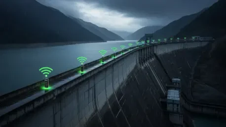
Integrating Satellite Technology for Constant Connectivity
Using Satellite as a Fail-Safe Layer: Constant Network Access
Satellite IoT is becoming an essential solution to the connectivity crisis by providing a complementary layer to existing cellular networks that functions entirely independently of terrestrial infrastructure. Most water monitoring tasks do not require the massive bandwidth used by consumer devices; instead, they involve sending small but critical packets of information, such as threshold alerts, daily status updates, or emergency breach notifications. Because satellite signals originate from space, they are unaffected by local power outages, terrestrial network congestion, or the physical limitations of mountain ranges and deep valleys. This provides a unique advantage for remote sites that have been historically difficult to monitor in real time. By integrating satellite connectivity, water managers can ensure that their most important signals reach their destination regardless of what is happening on the ground, effectively eliminating the “black holes” that have plagued remote monitoring for years.
The integration of satellite technology also serves as a vital fail-safe that guarantees the delivery of time-sensitive information when other systems are compromised. During a natural disaster, such as a major hurricane or an earthquake, local cellular towers are often the first pieces of infrastructure to go offline due to power failure or physical damage. In these scenarios, having a satellite-enabled IoT device ensures that critical data regarding reservoir levels or dam integrity continues to flow to emergency responders without interruption. This level of resilience is becoming a standard requirement for high-consequence infrastructure, where the cost of a missed alert far outweighs the investment in a multi-layered communication strategy. By using satellite as a persistent backup, utilities can achieve a level of operational continuity that was previously impossible, ensuring that their oversight of vital water resources remains intact even during the most severe environmental disruptions.
Adopting Hybrid Communication Models: Prioritizing Critical Data
The most effective strategy for modern water management involves the adoption of a “hybrid connectivity” model, which intelligently prioritizes data based on its urgency and the current state of local networks. Under this approach, routine information such as non-essential status checks or high-volume firmware updates can be sent via cost-effective cellular paths when they are available and stable. However, the system is programmed to recognize when a specific data point—such as an emergency overflow alert—requires immediate transmission. In these cases, the device can automatically switch to a satellite link to guarantee delivery, bypassing any local network issues. This dual-path strategy allows engineers to design systems that are both economically efficient and highly reliable, balancing the low cost of terrestrial data with the guaranteed reach of satellite communications to create a seamless and dependable monitoring experience.
From an engineering perspective, this represents a significant shift toward “designing for intermittent connectivity” rather than assuming a perfect link will always be available. Developers are now building intelligent logic into their field devices that can assess the health of the available networks and select the most appropriate route for every transmission. This prevents the loss of data during brief cellular outages and ensures that high-priority triggers are never stuck in a buffer waiting for a signal to return. By treating the communication path as a dynamic variable rather than a static connection, water utilities can significantly improve the uptime of their remote monitoring stations. This architectural resilience is particularly important for vast, distributed networks where manual intervention is difficult and expensive. Ultimately, the hybrid model ensures that the most important information is always the first to arrive, providing operators with the real-time visibility they need to manage complex water cycles.
Optimizing Performance Through Smart Infrastructure
Implementing Edge Computing and Local Intelligence: Processing at the Source
By combining satellite IoT with edge processing, modern sensors are becoming smart enough to process complex data locally rather than simply streaming raw numbers to a central cloud server. In this configuration, the field device acts as a miniature command center, analyzing incoming sensor readings in real time to identify patterns or anomalies that require immediate attention. For example, if a sensor detects that a water level has crossed a dangerous threshold or that a specific chemical concentration is rising rapidly, it does not wait for a central server to tell it what to do. Instead, the edge device identifies the breach at the source and immediately triggers a high-priority satellite alert to notify emergency teams or activate local hardware. This localized decision-making reduces the dependency on a constant high-bandwidth connection and ensures that critical actions are taken in milliseconds, rather than waiting for a full data round-trip.
This synergy between edge intelligence and satellite connectivity is particularly transformative for active infrastructure management, such as the operation of remote pump stations or sluice gates. If an upstream sensor detects a sudden surge in water volume that could lead to downstream flooding, the edge-enabled device can send a direct satellite signal to trigger a downstream pump, even if the local cellular network is completely down. This creates a clear, automated audit trail that documents exactly when the threat was detected and when the response was initiated, providing invaluable data for post-incident analysis. Furthermore, by only sending high-value alerts or summarized data over the satellite link, utilities can significantly reduce their data consumption and power usage. This efficiency extends the battery life of remote devices, allowing them to remain operational in the field for years without maintenance, while still providing the high-speed response capabilities needed for modern safety.
Building Resilience into System Architecture: Transforming Data into Assets
The ultimate value of any IoT deployment in the water sector depends on the confidence that stakeholders have in the resulting data, and bridging the connectivity gap is the only way to ensure that confidence. Organizations must move beyond the era of experimental pilots and begin building multi-layered reliability into their system architecture from the very start. This means selecting hardware that supports multiple communication protocols and partnering with providers that can offer seamless integration between terrestrial and space-based networks. By eliminating blind spots in remote areas, water organizations can transform their monitoring networks from collections of uncertain records into trusted operational assets that can withstand the most rigorous regulatory demands. The future of the industry lies in this unified approach, where the strategic use of satellite technology ensures that no critical event ever goes unrecorded, regardless of how remote the location.
As water scarcity and environmental volatility continue to challenge global infrastructure, the ability to monitor resources with total precision became the baseline for successful management. In recent years, the industry moved away from siloed technologies toward integrated solutions that prioritized uptime and data verifiable at every step. Engineers focused on creating self-healing networks that automatically rerouted information when traditional paths failed, ensuring that operational visibility was never lost. These advancements allowed utilities to respond to crises with unprecedented speed, preventing environmental disasters before they could escalate. By investing in resilient communication architectures, the sector proved that it was possible to maintain high standards of transparency even in the most challenging terrains. The transition to this robust, multi-layered model provided the final link in the chain of data integrity, allowing the water industry to finally close the connectivity gap and embrace a truly data-driven future.